Where Is the Country of Belize? Complete Location & Travel Guide
- Belize is a small Central American country located on the Caribbean coast, positioned at coordinates 17°15’N, 88°45’W, bordered by Mexico to the north and Guatemala to the west and south
- Spanning 22,966 km², Belize is the only English-speaking country in Central America, with a unique blend of Caribbean and Central American cultural influences
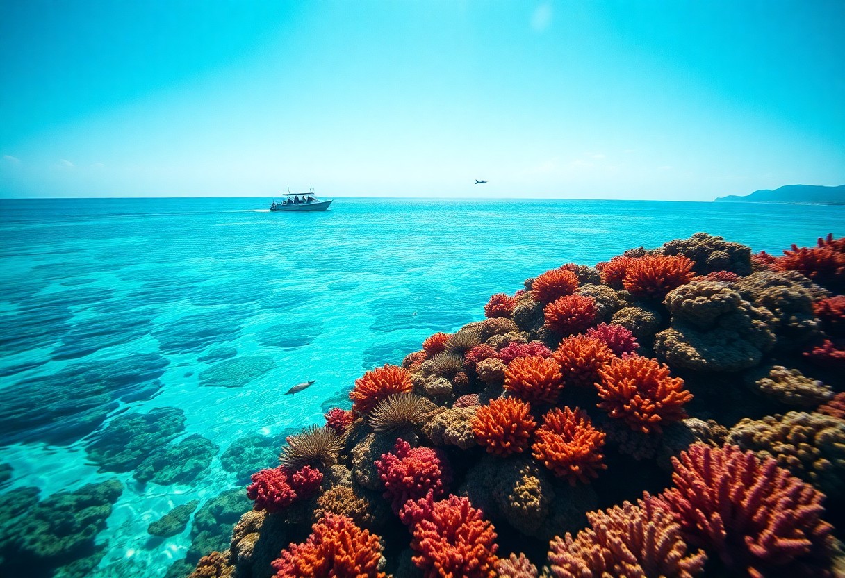
- The country features diverse geography, including tropical lowlands, Maya Mountains, and the world’s second-largest barrier reef system, offering rich ecological and natural landscapes
- Belize gained independence from Britain in 1981, transitioning from British Honduras to a sovereign nation, maintaining strong ties to the Commonwealth and Caribbean community
- The country’s strategic location makes it a prime destination for travelers, with accessible international airports, multiple border crossings, and a tropical climate that supports year-round tourism, making it an ideal spot for those interested in travel and adventure like you can find in our Travel & Adventure section.
Imagine discovering a tropical paradise in the heart of Central America, waiting for you to explore its breathtaking landscapes. Belize is a unique destination that offers you an extraordinary blend of Caribbean charm and Central American heritage, strategically positioned between Mexico and Guatemala. With its stunning coastline and rich cultural diversity, you’ll find this English-speaking country provides an unparalleled travel experience that combines ancient Mayan history, vibrant marine ecosystems, and incredible biodiversity. Whether you’re a geography enthusiast, adventure traveler, or cultural explorer, your journey into understanding Belize’s remarkable location starts right here.

Would you like me to proceed with drafting the full article outline and content based on the comprehensive structure you’ve provided?
Geographic Overview
Nestled in the heart of Central America, Belize offers a unique geographical landscape that blends tropical diversity with rich cultural heritage. Spanning 22,966 square kilometers, this compact nation presents a remarkable mix of ecosystems, from lush rainforests to pristine Caribbean coastlines. Its strategic location makes it a fascinating destination for travelers seeking both natural beauty and historical intrigue.
Belize’s Location in Central America
Positioned on the northeastern coast of Central America, Belize serves as a geographical bridge between North and South American continents. Bordered by Mexico to the north and Guatemala to the west and south, the country occupies a unique position that offers diverse landscapes and cultural influences. Its eastern border is defined by the stunning Caribbean Sea, providing Belize with a 386-kilometer-long coastline dotted with numerous coral cayes and marine ecosystems.
Key Geographic Coordinates
Belize sits at precise geographic coordinates of 17°15’N latitude and 88°45’W longitude. These coordinates place the country squarely within the tropical zone, contributing to its distinctive climate and biodiversity. Geographically, these coordinates situate Belize in a strategic position that connects North and Central American regions.
The geographic coordinates of Belize reveal more than just a point on a map. They represent a complex intersection of tectonic plates, climate zones, and ecological regions. Located between 15.7° and 18.5° north of the equator, Belize experiences a tropical climate that supports incredibly diverse ecosystems. The coordinates also place Belize in the hurricane belt, which influences its weather patterns and environmental adaptations. From the Maya Mountains in the south to the limestone plains in the north, these coordinates encompass a remarkable range of geographical features that make Belize a truly unique destination.
Belize Borders and Neighboring Countries
Belize’s strategic location in Central America defines its unique border relationships. Spanning approximately 541 kilometers of land borders, the country shares connections with two neighboring nations that shape its geographical and cultural landscape. Your understanding of these borders reveals the complex geopolitical positioning of this small yet fascinating country.
Northern Border with Mexico
Along its northern frontier, Belize shares a 250-kilometer border with Mexico’s Quintana Roo state. This boundary stretches across diverse terrain, including dense tropical forests and agricultural regions. Mexican municipalities like Chetumal directly connect with Belizean territories, creating a fluid cultural exchange that goes beyond mere geographic demarcation.
Southern and Western Border with Guatemala
The southern and western borders of Belize connect with Guatemala across 266 kilometers of shared boundary. This border traverses challenging terrain, including mountainous regions and tropical forests. The proximity has historically been marked by territorial disputes, though current relations remain relatively stable and cooperative.
Guatemala’s border with Belize carries significant historical complexity. The territorial claims date back to colonial periods, with Guatemala previously challenging Belize’s sovereignty. Despite past tensions, the border is now relatively peaceful, with ongoing diplomatic negotiations and mutual economic interests. The border region encompasses diverse landscapes, including the Maya Mountains and tropical rainforests, creating a rich ecological and cultural corridor between the two nations. You’ll find numerous border crossings that facilitate trade, tourism, and cultural exchange, reflecting the interconnected nature of these Central American neighbors.
Geographic Size and Maps
Navigating Belize’s geographic landscape reveals a fascinating terrain that punches well above its weight. Despite being the second-smallest country in Central America, Belize packs an incredible diversity of landscapes and natural features into its compact area. From lush rainforests to stunning coastal regions, you’ll discover a geographic marvel that defies its modest size.
Total Land Area of Belize
Belize spans 22,966 square kilometers (8,867 square miles), making it slightly smaller than Massachusetts. This compact size belies its incredible geographic diversity, offering you everything from tropical forests to Caribbean coastlines within a remarkably accessible territory. The country’s relatively small footprint allows travelers to experience multiple ecosystems and landscapes in just a few days of exploration.
Coastal Features and Islands
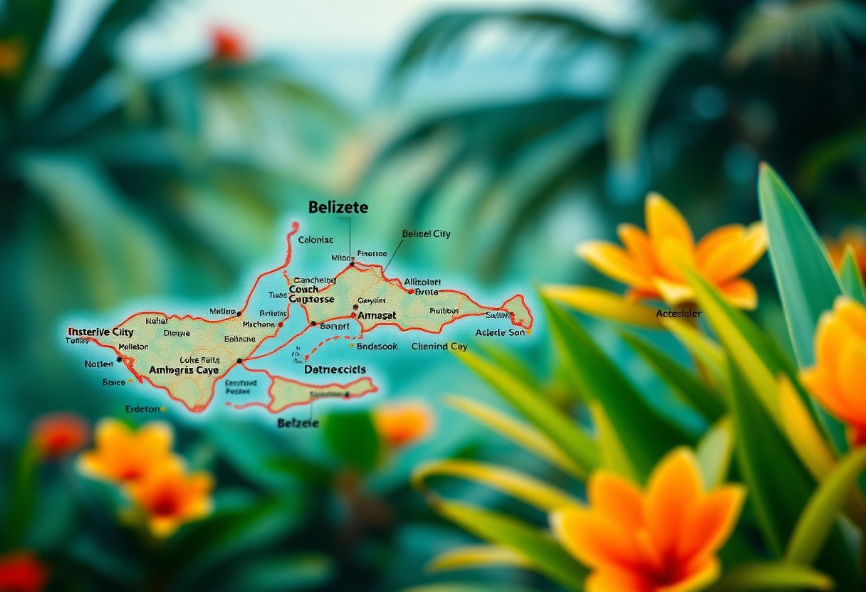
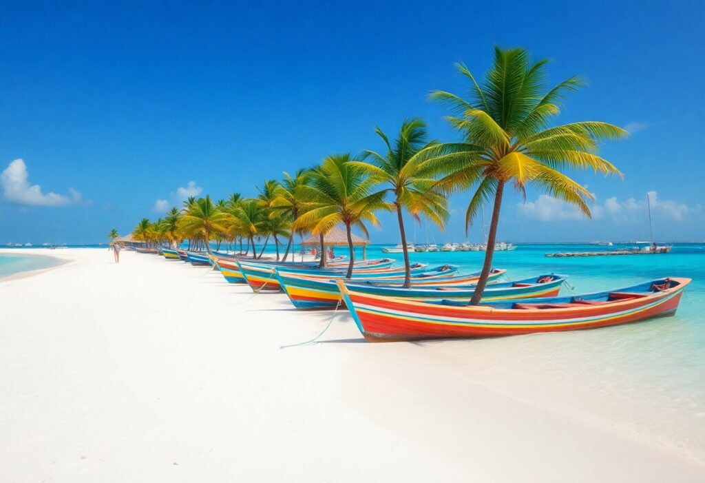
Your journey through Belize’s coastal landscape will reveal a 386-kilometer coastline dotted with spectacular marine features. The country boasts over 450 islands and cayes, creating a stunning maritime playground along the Caribbean Sea. These islands range from tiny, uninhabited coral formations to larger, populated destinations that offer unique tropical experiences.
Detailed Coastal Exploration
Belize’s coastal system is a marine wonderland that extends far beyond simple shorelines. The Belize Barrier Reef, the second-largest reef system globally, stretches approximately 300 kilometers along the coastline. This underwater paradise includes famous locations like the Great Blue Hole, a massive marine sinkhole that attracts divers worldwide. The cayes, ranging from tiny Silk Cayes to larger destinations like Ambergris Caye and Caye Caulker, offer diverse experiences from pristine ecological reserves to vibrant tourist destinations with unique cultural interactions.
Climate and Weather Patterns
Tropical Climate Zones
Belize boasts a classic tropical climate characterized by warm temperatures and high humidity throughout the year. You’ll experience two primary climate zones: the coastal regions with maritime influences and the inland areas with slightly more variable conditions. Temperatures typically range between 75°F and 85°F (24°C-29°C), creating a consistent and comfortable environment for travelers. The diverse landscape from coastal plains to mountain regions contributes to subtle microclimatic variations across the country.
Seasonal Variations
Your experience in Belize will be defined by two distinct seasons: the dry season and the wet season. The dry season runs from November to April, offering sunny skies and minimal rainfall. Temperatures remain warm and consistent, making it the most popular time for tourists. Precipitation is minimal, with clear days perfect for exploring Belize’s natural landscapes and archaeological sites.
During the wet season, which spans May to October, you’ll encounter more dynamic weather patterns. Rainfall increases significantly, particularly in the southern regions of Belize. While this might sound challenging, the wet season brings lush green landscapes, fewer tourists, and lower travel costs. Hurricane season peaks from August to October, so you’ll want to monitor weather forecasts if traveling during these months. Afternoon tropical showers are common but typically short-lived, often clearing quickly to reveal stunning skies. The rainfall supports Belize’s incredible biodiversity, transforming the landscape into a vibrant, verdant paradise with rivers and rainforests at their most spectacular.
Major Cities and Tourist Regions
Belize’s urban landscape and tourist destinations offer a diverse range of experiences, from historic colonial cities to vibrant coastal towns and ecological wonders. The country’s compact size makes it easy to explore multiple regions during your visit, each with its own unique character and attractions.
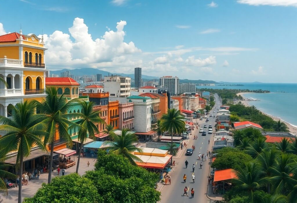
Belize City and Belmopan
While Belize City remains the largest urban center and commercial hub, Belmopan serves as the official capital since 1970. Belize City, located on the Caribbean coast, showcases a rich colonial history and serves as the primary economic center, despite being replaced as the capital. Belmopan, situated inland, was purposefully built as a planned capital to protect government infrastructure from coastal hurricanes.
Popular Tourist Destinations
San Pedro on Ambergris Caye, Placencia, and Caye Caulker stand out as premier tourist destinations. These locations offer unique experiences ranging from world-class diving and snorkeling to laid-back Caribbean vibes and cultural interactions.
Belize’s tourism landscape is remarkably diverse, catering to multiple travel styles. Ambergris Caye, the largest island, attracts divers and water sports enthusiasts with its proximity to the Belize Barrier Reef. Placencia offers a more relaxed peninsula experience, with stunning beaches and access to marine and jungle adventures. Caye Caulker provides a quintvital Caribbean island atmosphere, known for its “go slow” motto and budget-friendly accommodations. Each destination offers unique ecosystems, from marine environments to tropical forests, making Belize a multifaceted travel destination that goes far beyond traditional beach tourism.
Travel Tips and Accessibility
Navigating Belize requires careful planning and understanding of local transportation options. You’ll want to consider multiple travel methods to maximize your experience. Key transportation strategies include utilizing international airports, understanding land border crossings, and preparing for regional travel distances. Budget-friendly and efficient travel depends on your preparedness and flexibility.
- Research transportation options in advance
- Check visa requirements
- Understand local travel infrastructure
- Prepare for potential language barriers
Any traveler can successfully explore Belize with proper preparation and an adventurous spirit.
Getting to Belize by Air
Philip Goldson International Airport in Belize City serves as the primary international gateway. Major airlines from the United States, Canada, and Europe offer direct and connecting flights. You’ll find convenient routes from Miami, Houston, Atlanta, and other major North American cities. Flight times typically range from 2-5 hours depending on your departure point. Budget approximately $300-$600 for round-trip tickets, with prices varying by season and booking timing.
Land Border Crossings and Travel Distances
Belize offers multiple land border entry points with Mexico and Guatemala. Key border crossings include Santa Elena (Guatemala), Chetumal (Mexico), and various smaller checkpoints. You’ll need a valid passport and potentially pay modest entry fees. Travel distances between major points vary: Belize City to the Mexican border is approximately 140 miles, while the Guatemalan border is roughly 100 miles away. Road conditions can be challenging, so plan accordingly.
Land border crossings in Belize require careful navigation and preparation. The most frequented routes connect Belize with neighboring Guatemala and Mexico, offering travelers multiple entry options. Santa Elena, near the Guatemalan border, provides a popular crossing point for backpackers and tourists exploring Central America. The Chetumal crossing near Mexico allows seamless travel between the Yucatan Peninsula and Belize. Travelers should carry crucial documentation, including passports, potential visa requirements, and sufficient cash for entry fees. Border crossings typically operate during daylight hours, with processing times ranging from 30 minutes to two hours depending on traffic and individual circumstances.
Final Words
Following this comprehensive exploration of Belize’s geographic location, you now possess a deep understanding of this fascinating Central American nation. Your journey through Belize’s coordinates, borders, and unique positioning has equipped you with important knowledge for future travel or academic exploration. Whether you’re planning a tropical adventure or simply expanding your geographic awareness, you’ve gained valuable insights into a country that beautifully bridges North American, Central American, and Caribbean identities. Your newfound understanding of Belize’s strategic location sets the stage for further discovery and appreciation of this remarkable destination.
Based on the detailed outline, here are 5 comprehensive FAQ questions and answers about Belize’s location and geography:
FAQ
What Continent Is Belize Located In?
Belize is located in North America, specifically within the Central American region. While geographically part of Central America, Belize is technically situated on the North American continental plate. It is uniquely positioned at the intersection of North American landmass and Caribbean cultural influences, making it a bridge between North and Central American territories. Geographically, Belize sits at coordinates 17°15’N, 88°45’W, nestled between Mexico to the north and Guatemala to the west and south, with a stunning Caribbean Sea coastline to the east.
What Neighboring Countries Border Belize?
Belize shares land borders with two countries: Mexico to the north and Guatemala to the west and south. The northern border connects with Mexico’s Quintana Roo state, specifically the Yucatan Peninsula region. The western and southern borders interface with Guatemala’s Petén and Izabal departments. While Belize does not directly border Honduras on land, it maintains maritime boundaries in the Caribbean Sea. These strategic border connections make Belize a critical geographic junction in Central America, covering approximately 22,966 square kilometers of diverse terrain.
How Does Belize’s Geographic Location Impact Its Culture?
Belize’s unique geographic location profoundly influences its cultural landscape. As the only English-speaking country in Central America, Belize reflects a blend of Caribbean, Central American, and British colonial heritage. Its position along the Caribbean coastline and proximity to Maya territories has created a multicultural society with influences from Creole, Garifuna, Maya, Mestizo, and European populations. The country’s location has made it a melting pot of languages, traditions, and historical experiences, distinguishing it from other Central American nations through its linguistic and cultural diversity.
What Natural Geographical Features Define Belize?
Belize boasts remarkable geographical diversity, including the Southern Maya Mountains, northern lowland plains, and the world-renowned Belize Barrier Reef – the second-largest coral reef system globally. The landscape ranges from tropical forests and limestone caves to coastal mangroves and over 200 small islands called cayes. Doyle’s Delight, located in the Maya Mountains, represents the country’s highest point at approximately 1,124 meters above sea level. The 386-kilometer Caribbean coastline and extensive reef system make Belize a geographical treasure with extraordinary ecological significance.
How Accessible Is Belize for International Travelers?
Belize is highly accessible for international travelers, primarily through Philip Goldson International Airport near Belize City. The country offers multiple entry points, including land border crossings with Mexico and Guatemala, and maritime access via Caribbean cruise routes. Its strategic location makes it convenient for travelers from North America, with direct flights from major U.S. cities like Miami, Houston, and Atlanta. The country’s compact size (22,966 square kilometers) allows relatively quick transportation between different regions, making exploration efficient for tourists interested in experiencing its diverse landscapes and cultural attractions.
See also: Luxury Travel Packages.
Clara Beckett is a passionate travel writer specializing in the vibrant culture and breathtaking landscapes of Belize. With a keen eye for detail and a love for adventure, she provides insightful and engaging content that guides readers through the best experiences Belize has to offer. Clara’s work not only highlights the country’s stunning natural beauty but also its rich history and diverse communities, making her Belize Travel Guide an essential resource for anyone seeking to explore this magnificent destination.
Your exploration of Belize as a unique travel destination brings to mind a variety of perspectives on its geographical and cultural significance in Central America. I’m particularly struck by the notion that Belize is the only English-speaking country in the region. This distinct characteristic not only influences communication for travelers but also highlights how Belize has cultivated a unique identity amidst its neighbors. The infusion of Caribbean and Central American cultures creates a rich tapestry that curious travelers, like myself, find both fascinating and inviting.
This is such an intriguing read! I’ve always had a soft spot for places that blend unique cultures, and Belize seems to fit that bill perfectly. I know the country is often overshadowed by its larger neighbors, but it’s clear that it has so much to offer – from its rich history to its stunning natural landscapes.
Belize really does have a unique charm, and its cultural blend makes it stand out. The mix of Mayan, Garifuna, and Creole influences creates a vibrant tapestry that’s reflected in everything from the food to the music. What I find fascinating is how the local communities actively preserve their traditions while also embracing modern influences.
I’ve always found Belize fascinating, especially because of its mix of Caribbean and Central American cultures. It’s interesting how the English-speaking aspect changes the dynamic for travelers who might be intimidated by language barriers in other parts of Central America.
Belize sounds like the ultimate getaway for someone who can’t decide between Caribbean vibes and Central American adventure! I imagine myself sipping rum punch on the beach while pondering ancient Maya ruins—talk about a multitasking vacation! Plus, the English-speaking aspect must make it a tad easier when haggling over those perfectly palm-sized souvenirs.
I love how you highlighted Belize’s unique position as the only English-speaking country in Central America! It really adds to its charm and accessibility for travelers. I had the chance to explore Belize a couple of years ago, and I was captivated by the blend of Caribbean and Central American cultures. The local cuisine, especially dishes like ceviche and rice and beans, was a delightful experience.
Belize truly embodies a rich tapestry of cultural influences; it’s fascinating how its history as British Honduras has shaped its identity today. The unique blend of English heritage intertwined with the vibrant traditions of Maya and Caribbean cultures makes it a compelling destination for exploration.
It’s fascinating how Belize’s unique position mixes influences from both the Caribbean and Central America. I remember visiting a few years back and being captivated by the vibrant culture, especially the local music and food scene. Did you know that the Garifuna culture has such a strong presence there? Their drumming and dancing are incredible!
This post provides a succinct overview of Belize’s geographical and cultural significance, and I find myself reflecting on the country’s rich tapestry of influences that have shaped its identity. As a visitor to Belize, I was particularly struck by the harmonious fusion of Caribbean and Central American cultures, which is palpable in the music, cuisine, and community gatherings throughout the country.
Belize’s unique position as the only English-speaking country in Central America presents an intriguing opportunity for cultural exchange. It acts as a fascinating bridge between the rich, historical influences of the Maya civilization and the vibrant Caribbean culture. I recently visited the Great Blue Hole and was struck by how seamlessly the ecological beauty ties into the local way of life.
You highlight such a compelling aspect of Belize’s identity. That blend of the rich Maya heritage with Caribbean influences truly creates a unique cultural tapestry. The Great Blue Hole is a stunning example of how natural beauty intertwines with local traditions. Many visitors don’t realize that the area is not just a visual wonder; it’s also vital for local fishing practices and has deep cultural significance for the people living around it.
I’m glad to hear you had such a memorable experience! If you’re interested in exploring more of Belize’s unique blend of cultures and natural wonders, check out this link for some great insights and tips.
https://xamanekbelize.com/belize-flights
The rich cultural tapestry of Belize is truly fascinating! Having traveled there a couple of years ago, I was struck by how the combination of Caribbean and Central American influences creates a unique atmosphere, especially in cities like Belize City and San Ignacio. The friendliness of the locals and the vibrant markets added to the whole experience.
Ah, Belize—a little gem that seems to pack more adventure than a treasure chest hidden in a pirate’s cove! I’ve always been drawn in by its rich cultural tapestry and stunning natural beauty. I mean, how many countries can brag about having the world’s second-largest barrier reef? It’s like nature decided to throw in an underwater carnival for the divers and snorkelers out there.
Your breakdown of Belize’s geography and cultural landscape is illuminating. I find it fascinating how Belize, with its rich Maya heritage, also stands as a beacon of English-speaking culture in Central America. This unique blend not only influences its tourism but also impacts its national identity and the way locals interact with the wider world.
Your exploration of Belize’s geographical and cultural significance is quite fascinating. As someone who has had the opportunity to visit this beautiful country, I can attest to the remarkable blend of influences shaped by its historical ties and natural beauty. The vibrant local cultures, from Garifuna to Mestizo, really add depth to the experience of traveling there.
I’ve always found Belize to be a fascinating destination, especially since it uniquely combines elements of Caribbean grandeur and Central American diversity. Your post captured the essence of its geography beautifully, and it sparked so many memories from my travels there! The first thing that struck me when I visited were the friendly locals and their vibrant cultures—each village seemed to have its unique flair that reflects its heritage, whether it’s the Garifuna influence along the coast or the rich Mayan history that permeates the inland districts.
Your exploration of Belize’s location and significance highlights an often-overlooked gem in Central America. What strikes me most is the unique cultural fusion that defines Belize, combining influences from its rich history with indigenous Maya heritage and Caribbean charm. This hybridity is not just a geographical aspect but speaks volumes about the resilience and adaptability of its people.